Posts Tagged With: WA

Bird Watching – Bunbury (Western Australia) To Shelly Beach (South Australia)

12/12/16

Categories: Bird Watching | Tags: , , , , , , , , , , , , ,

Mundrabilla Roadhouse – Nullarbor Bush Camp (Western Australia)

8/12/16  Di and I left the bush camp at Woorlba East heading for our next overnight stop at Mundrabilla Roadhouse, about 90kms short of the South Australian border. We’d arranged to meet up again with Charles and Joy there.

There was just a barely noticeable lightness to the rig on the drive which I put down to a breeze that was blowing the grass around outside, but we didn’t realise just how windy it had become until pulling in at Cocklebiddy Roadhouse for fuel. A strong westerly tail wind had come up during the morning, giving us a push along. It was that kind of wind you had to lean into to walk against, and opening the car door was a feat of strength and determination.

img_2480While fuelling, we could see just ahead an immense column of smoke from a bushfire ignited by lightning strikes the day before. It looked to be a monster, fed by the strong wind conditions. And, strangely, sitting on top of the high column of heat and smoke was an immense cumulus cloud that boiled in on itself, looking very angry. Whether it was the cause of the bushfire or the effect of it was hard to tell. We finished fuelling and headed on, learning later at Mundrabilla that shortly after we’d gone through, the fire had changed direction causing the closure of the Eyre Highway for the rest of the day and night.

img_9821 It was certainly a day for avoiding Nature’s wrath. Firstly the bushfire and then, at Mundrabilla Roadhouse, we waited out a widespread warning of severe thunderstorm and damaging hail. The rig was still hitched up and the plan was to head under the servo awning if the hail hit. But, fortunately, the storm didn’t eventuate in our area – just the strong winds that rocked and shook the van all afternoon. Charles and Joy went further on to Eucla while we stayed the night at the Mundrabilla Roadhouse.

On the way into WA in July, I’d played all the holes on the Nullarbor Links Golf Course, the world’s longest course, apart from two and had also missed getting my card stamped at a third hole. Now that we were going back again, I dusted off the versatile 5-iron, played the remaining holes at Eucla and Border Village at my usual level of golfing excellence, and had the missing stamp inserted at Mundrabilla. My scorecard was full and I’ll be collecting my certificate at Ceduna.

Unfortunately, the rain that prevented us from doing the Old Eyre Highway between Nullarbor Roadhouse and Border Village in June, again put paid to doing the stretch on the way back. Bummer! It’ll have to keep until next time.

We stopped for lunch at the 52km marker on the Nullarbor and decided to stay the night, tucked away beside a gravel heap a couple of hundred metres from the highway and near the ocean cliff. SA National Parks are serious about keeping vehicles away from the cliff edge. They not only install bollards to block vehicle access, but scarify rocks up on the tracks as well.

Crossing the WA/SA border took us into different time zones, and clocks were reset to SA time.

Don’t forget to turn your clock back. I’m going to turn mine back to when I was twenty.

Categories: Travel News, Travel News - Multiple States, Travel News - South Australia, Travel News - Western Australia | Tags: , , , , , , ,

Deralinya Homestead – Woorlba East Bush Camp (Western Australia)

6/12/16  Duke of Orleans Bay is located east of Esperance, halfway to Cape Arid National Park where the road ends. From there, to connect with the Eyre Highway to cross the Nullarbor, we’d have to backtrack 85kms west to Esperance and then head 200kms north to Norseman, the start of the Eyre Highway east. It’s a long way around, and mostly in the wrong direction. So, after discussing road conditions with a couple of blokes at The Duke, we decided to take a short cut.

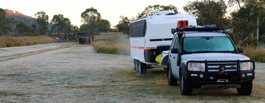
The 200km-long Parmango Road heads north-east to connect with the Eyre Highway at the Balladonia Roadhouse, saving about 170kms. It’s not your usual run-of-the-mill backroad though. After the first 40kms of bitumen, the road changed to a wide, well-maintained gravel surface. But, the further north we went, the road narrowed and got rougher. The tyres were aired-down by 10psi, and we loped along pretty steadily at 60-70kph. We weren’t in any hurry and were enjoying the track as it was scenic and interesting.

As far as being a short cut, though, it took us two days to do the 200kms. We’d planned it that way. We camped overnight halfway along the track at the old Deralinya Homestead. Built in the 1890s as a sheep station and abandoned in 1926, the small stone homestead and couple of outbuildings fell into disrepair. These days, they are in good condition, restored by the absentee owner, stonemason Roger, who happened to be camped there doing some work when we arrived.

Roger and his mate have been doing the restoration work since 1990, guided by a painting of the homestead done in 1906. He showed us around the old buildings, pointing out the restored stone and timber work which was very much in keeping with the look and texture of the original structure. It was fascinating to get a glimpse of how different life must have been for the early settlers. Roger was chuffed with the eccentricities of the original construction of the buildings that weren’t even close to being square. Lime cement (not concrete) had been used throughout the walls and floor, made on the property using lime kilns that were still evident. A working brick oven was located in the front yard, built by the original settler who apparently loved bread so much that he constructed ovens throughout the property wherever he was likely to camp for a period of time.

In the scrub a short walk from the homestead, an extensive area of flat granite forms a natural catchment for rainwater. Taking a walk, we came across a few gnamma holes, deep natural holes in the rock that collect and store rainwater for a good period of time following rain. One hole was still covered by three rock slab “lids” to prevent evaporation of the contents, and another contained what I reckoned had to be several hundred litres of water. How useful would these holes have been to the first peoples and the early settlers in this dry country! In the books that I’ve read recently about early explorers in WA and SA – “Eyre: The Forgotten Explorer”, Ivan Rudolph; “Sturt’s Desert Drama”, Ivan Rudolph – gnamma holes and native wells regularly sustained the explorers when they were on their last legs.

img_2323

The usually unoccupied homestead was fascinating in its own right, and with the owner there, we were very fortunate to be able to learn a bit of the history of the property and its earlier inhabitants, along with his efforts to maintain the historic integrity of the homestead to which he intends to retire in a few years. It’s wonderful that he kindly allows travellers to visit and camp at the old homestead on their way through.

In as much as the 109km drive in to Deralinya Homestead from the south was pretty good, the 83km drive out the next morning to the Eyre Highway was just the opposite. North from the homestead, the track became a slow, rough slog. If it wasn’t corrugated, it was stoney, and if it wasn’t stoney, it was corrugated. And often as not, it was both. A quick but spectacular thunderstorm that passed overhead as we arrived at Deralinya the day before had dropped some rain on our next stretch of track. For the first 30kms, we sloshed through section after section of water lying across the track. It was no problem for the Landy and Kruiser to negotiate, though. Then we came to sections where it wasn’t water but mud across the track. This was followed by dry sections of bull dust. The van and Landy were firstly wet down, then covered with a layer of mud and then a layer of fine bull dust that turned the rig and tyres white, along with us if we happened to touch it. At best, we managed 40kph and at worst, 20kph. With occasional stops to cool down the shocks and heat up a cuppa, it took us most of the morning to get up to the bitumen.

img_2444aOur little shortcut had been a big adventure that we really enjoyed. Even so, it was a relief to at last reach the Eyre Highway and Balladonia Roadhouse. Pulling in to refuel and air up, we spotted Charles and Joy, who we’d first met at Esperance and then again at Duke of Orleans Bay. They were heading east in their van and we camped together that night in a shady spot off one of the many tracks into the scrub behind Woorlba East Rest Area, at the start of the 90 Mile Stretch. We were the only ones there and, although a little windy and dusty, the campsite was a pleasant one. We finished the day wrapped around a nice drink or two.

“Not many cars on the road, hey!” Pete, speaking loudly over the corrugations ahead of a cloud of bull dust.

Categories: Travel News, Travel News - Western Australia | Tags: , , , , , , , , ,

Esperance – Duke of Orleans Bay (Western Australia)

2/12/16  We stayed in the town of Esperance for a couple of days to restock the food, water and wine supplies. Di had a tune-up at the chiropractor while I got a Bunnings-fix. Our “chi”s were once again in balance.

It had been recommended that we do the tourist loop drive just out of town, and we’re very glad that we did as the scenery was spectacular. The drive took us about 20kms west along the shoreline where the high heath-covered coastal hills dropped sharply into the sea at picture-postcard beaches and coves. We had not seen water that shade of blue before. With the granite rocks and brilliant white sand, it had a Greek Isles look about it.

People had raved about Duke of Orleans Bay, located a short drive east towards Cape Le Grand National Park, so we thought we’d check it out next. We set up on the beach side of the quirky little caravan park, with access to the beach via a short, narrow path through the vegetation. From the beach, the view across the water to a few small rocky islands in the bay was terrific, but the beach itself was a foot deep in seagrass and not very appealing. The real attraction was Wharton Beach, a 3km drive away on the opposite side of the point, where we could access the 4km-long beach by vehicle. It was certainly a very beautiful spot. Di was determined to go for a swim and coaxed me and the boys in for a very bracing swim in the cold Southern Ocean. Coming from Queensland with its very popular beaches, we found it odd to see these wonderful WA beaches almost deserted and generally with no-one in the water. The reasons twofold – the water is that much colder, and the sharks are that much bigger. People seem to take sharks much more seriously over here.

Last year, we were 222 days away from home on a 21,800km trip through western Queensland, Northern Territory and South Australia – the biggest trip in the van so far. Arriving at Duke of Orleans Bay on our 223rd day of this year’s trip to Western Australia, we’d exceeded our previous record. So far, we’ve covered 25,550kms, and still have a lot more to go before we’re back home again.

“And the end of all our exploring will be to arrive where we started and know the place for the first time.” – T.S. Elliot

Categories: Travel News, Travel News - Western Australia | Tags: , , , ,

Pallinup River Nature Reserve – Overshot Hill Nature Reserve (Western Australia)

30/11/16  Our camp spots are generally planned in advance, although “planned” is a bit of an overstatement – it’s more like which way we’ll be going and where we could be staying for the next few stopovers. I have a notebook in which I list the next four or five best looking camp site possibilities, the travelling distance between them, and whether there’ll be power and water available or not. That’s then useful in planning around our food and on-board water supplies, and where the clothes might likely next be washed. How long we stay at each place is decided when we’re there. Some end up being just overnighters and some might be for a week if we like the place or just want to stay put for a while and “hub out” around the area in the Landy.

These plans are always very flexible though and often we end up doing something completely off-plan, as evidenced by the many crossed-out entries in my notebook. Serendipity – the fortunate accident – often plays its part. As an example, we left Albany heading for Cheyne Beach, 70kms to the east on the South Coast Highway. Along the way, with a very grey sky overhead, Di suggested we push on instead to Bremer Bay, 150kms further on. We pulled in for lunch at a little bush rest area at the bridge on Pallinup River, and with the weather still very overcast, cold and windy, stayed there for the night. Who wants to go to the beach when it’s overcast, cold and windy? The rest area bordered a nature reserve where we took a pleasant walk looking at birds and the remaining wildflowers of the season.

Heading off to Bremer Bay the next morning, we ended up instead at another pleasant little bush spot called Overshot Hill Nature Reserve, just north of Ravensthorpe, and had the place all to ourselves for the night. Di was teased by a small flock of budgerigars that were noisy but too quick to be seen in the thick bush. We haven’t come across these iconic Aussie birds in our travels so far. We woke to a flat battery in the Landy because I hadn’t disconnected the van when we set up. Dumb! Fortunately, we had mobile reception and a call to RACQ soon had Bob out from Ravensthorpe to give us a jump start. The strange thing was that I’d dreamt about a flat battery that night. Job to do – fit a battery isolator.

Overshot Hill Nature Reserve (WA)

Overshot Hill Nature Reserve (WA)

Spots like these, camped back from the road in among the trees, are pleasant one- or two-nighters – fortunate accidents (apart from the unfortunate flat battery).

“Life is what happens to you while you’re busy making other plans.” – John Lennon

Categories: Travel News, Travel News - Western Australia | Tags: , , , , ,

Albany (Western Australia)

29/11/16  The morning we left Peaceful Bay, we walked across to the park office to fix them up for the extra day we’d stayed, and while waiting at the unattended counter, came across a young woman sitting to one side weeping. Offering our assistance, we learned she was a French Canadian backpacker, who had come to Australia for 12 weeks to solo walk the 1000km long Bibbulmun Track from the hills outside Perth to Albany on the south coast. She had two weeks to go and, in the final stages of the trek, was suffering painful ligament damage in one ankle. We sat and chatted with her to see if there was anything we could do to help. It was plain to see she was absolutely exhausted, physically and emotionally. We took the park lady aside and offered to cover any accommodation costs while the girl rested up and recuperated, but they were going to provide it at no charge as they regularly looked after travel-weary Bibbulmun walkers. By the time a lot of walkers have reached Peaceful Bay, they have hit “the wall” and apparently the next section to Denmark was the toughest of the entire walk. Some recuperate and carry on, some drop out and some skip that section and go on to finish the final leg to Albany. We hope she makes it through to complete her trek before heading back to Perth and then home to Canada.

Coming into Albany, we hit the 25,000km mark on this year’s trip. Albany is the first European settlement in Western Australia and sits on the sheltered Princess Royal Harbour, the best natural harbour in Australia outside Sydney. First stop on arrival was at the local Beaurepaires for a tyre to replace the cactus one I took off in Bunbury. Second stop was at the Land Rover dealer to have a look at a worrying squeal which had started up in one front wheel. I’d put it down to either a stone caught up against the brake disc, a worn brake pad, or a failing wheel bearing – or any one of a number of other complex mechanical things. Pulling off the wheel earlier, I couldn’t see anything lodged up in there and the pads were fine, so the prospect of a replacement wheel bearing (involving the entire hub assembly at no small price) was filling me with financial trepidation. Land Rover confirmed the bearing to be OK, and blew out a bit of road rubbish from the back of the hub so hopefully the problem is no more (touch wood!). We’ll need all four wheels working when going back across the Nullarbor, this time off the beaten track via the disused Old Eyre Highway section.

March flies have been a menace at the last couple of camps, especially so in Albany. Their saving grace, if they have one, is they are big and slow and, if missed, the buggers come back and you get another go! “Slap ‘em ‘n stand on ‘em” is the only sure-fire way to deal with them. If you don’t stand on them, they just get up and shake it off! Someone told us the other day if you slap them, they give off a scent that attracts more to you. I don’t know about that though. It seems there are plenty around regardless of what you do. I just like slapping them anyway. The Marchies have been so big that, at Peaceful Bay, as I slapped each one, I fed it to a magpie that was hanging around. Recycling at its best.

We visited the Princess Royal Fortress complex, overlooking Princess Royal Harbour from the top of Mount Adelaide. Built in the late 1800s, it has two gun batteries dug into the hillside to protect the harbour on the important shipping route to Europe. The nearby National Anzac Centre is dedicated to honouring the Anzacs of the First World War who embarked from Australia in 1914 in two convoys from Albany’s King George Sound.

Torndirrup National Park is very close to Albany, around the seaward side of Princess Royal Harbour. We spent a day sightseeing the very scenic beaches and cliffs, particularly The Gap where you can stand on a platform extending out over a chasm buffeted by massive waves from the Great Southern Ocean. At the nearby Blowholes, crevices in the high granite cliffs reach down to the sea below and expel air with each wave swell, sounding like breeching whales. We weren’t there at the right time to see them blowing water, though. There are some terrific beaches around Albany, some very calm and others great for surfing. The wind was still very cold though and kept us out of the water.

“It’s not fair! They promised me they fixed it! It’s not my fault!” – Han Solo, Star Wars Episode IV (Famous last words resounding in the still of the Nullarbor Plain night. Touch wood!!)

Categories: Travel News, Travel News - Western Australia | Tags: , , , , , , , , , , , , , , ,

Big Brook Arboretum – Peaceful Bay (Western Australia)

24/11/16  Big Brook Arboretum is a campground in Big Brook State Forest, 15kms north of the town of Pemberton. The final 5kms into the campground narrowed to a winding gravel road flanking the north side of a lake which provided the town with a water supply. We camped among towering Karri and Pine trees reaching up high overhead and dwarfing the van. The Karri trees were just magnificent. After setting up and having a cuppa, we walked a trail through the forest to the lake. Birdlife was evident but difficult to see through the thick forest growth and we had to be content with just their calls.

Heading on the next morning, we travelled 160kms south-east through lofty Karri forests to a very pleasant farmstay-like caravan park at Peaceful Bay on the southern coastline between the towns of Walpole and Denmark. We’d wanted to have a taste of the big WA freshwater crayfish and called in to Forest Fresh Marron at Pemberton. Much bigger than the QLD freshwater crayfish, the size of the WA variety was a real surprise, as was the fact that we’d be buying them live rather than already cooked and cryovaced. We selected four medium-sized snapping marron from a tank and they spent the day in the car fridge before being cooked and served up for dinner that night. Marron won’t be replacing prawns or mud crabs as our favourite menu item, but they were still pretty good. On the way to Peaceful Bay, we also stopped off at the small town of Northcliffe and did the interesting Understory Sculpture Walk where sculptures by local, national and international artists have been installed along a 1.2km pathway through a bushland setting. We especially liked the many charcoal faces that had been carved into burnt tree trunks from a severe bushfire two years earlier.

One of the WA birds that Di has really been hoping to see and photograph was the White-tailed Black-Cockatoo. They are native to the south-west corner of Western Australia and we’ve often heard their calls in the bush or glimpsed them flying overhead, but the opportunity to have a good look or a good photo as yet hasn’t presented itself. At Peaceful Bay, we took a long walk on the beach one morning and, for once, Di chose to leave her camera in the van. Of course, what did we come across but a gang of White-tailed Black-Cockatoos feeding on flowers of low shrubs in dunes at the top of the beach! And no camera! Di slowly worked her way to within just a few metres of them as they fed. And no camera! We looked at each other, mouthing “Can you believe this!” Just short of being close enough to touch one, she has vowed never ever to leave her camera behind again. And next time I get asked “Should I take my camera?” my response will be “What would David (Attenborough) do?”

On the second day at Peaceful Bay, Peter and Fleur, our NBFs from Perth, pulled in beside us with their van. We’d been hoping that they could join us when Peter got back from chasing the gold lust out west. It was good catching up again. We did a couple of day trips together to a few picturesque beach spots, checked out the award winning bakeries at the nearby town of Denmark, enjoyed a terrific platter lunch at The Lake House winery, walked the Valley of the Giants among the giant Tingle trees and walked to the Giant Tingle Tree and Circular Pool. It was a lot of fun. We extended our stay at Peaceful Bay and they extended theirs as well. Their deadline was the looming prospectors meeting in Perth that Peter wanted to attend.

img_9515Di at last got a good photo opportunity with the White-tailed Black-Cockatoos, and quickly moved on in search of the Red-winged Fairy-wren. These twitchers are an insatiable lot!

Being on the southern coastline of WA and heading east, it occurred to us that we were now sort of heading homeward. We have about two months to go until our intended return date which is still quite a lot of travel time, but heading east has brought home to us that the trip is starting to wind down, that we were on the return leg. Even so, ahead lies a lot of as yet unplanned travel – we have no idea how we’ll be returning home, and that’s the exciting part. All we know is that it won’t be over ground already covered if we can help it.

img_1010

Fleur and Peter – The Lake House Winery (WA)


“We’ll be friends ’til we’re old and senile… Then we’ll be new friends!” – Anonymous

Categories: Travel News, Travel News - Western Australia | Tags: , , , , , , , , , , , , , , , , , , , ,

Bunbury – Busselton (Western Australia)

17/11/16  Bunbury was our next destination. The looping drive that took us east from Perth to Darkan, Bridgetown and now Bunbury had brought us back to the coast only 170kms south of Perth, which was fine as we’d seen lots of very interesting and pretty countryside in the meantime. We travel to see things, not to cover distances.

As we drove around Bunbury’s points of interest, the Landy felt a little strange and wobbly, like a tyre had developed a high spot or something. So, back at the caravan park, it went up on the jack and each wheel in turn came off to be checked out. When the rear offside tyre came off – “Bloody hell!” – it was badly split and separating around the inner bead. While the outer sidewall looked fine, the inner was diabolical and ready to let go of the rim at any moment. Weirdly, it was still holding air pressure and looked quite normal on the Tyre Pressure Monitoring System. It was so lucky that I’d checked it, otherwise the tyre would definitely have blown very soon somewhere down the road, probably with the van attached. The tyre budget takes another hit. “Where’s that ring, Di?”

While in Bunbury, we met up with Murray and Jannine, who had just purchased a Kimberley Kruiser from Dean and Ros, the couple we’d met while in Perth. When we mentioned in passing to Murray and Jannine that we would be heading south from Bunbury, they very kindly offered us the use of their Busselton beach house to park the van. And we gratefully accepted.

Busselton is only 52kms to the south. The van was reversed onto the front yard of the beach house and plugged in to power. All the comforts of home. This was our camp for the next three days and a good base from which to see the South West Corner, the sticky-out bit at the bottom of WA.

We did day trips to Dunsborough, Cape Naturaliste Lighthouse and Yallingup, and particularly liked the million-dollars-for-a-look-in community of Eagle Bay. The beaches in the Corner were very scenic with magnificent shades of blue water. We covered much of the area down to Augusta and Cape Leeuwin Lighthouse, the most south-westerly point on the Australian continent and the point where the Indian and Southern Oceans meet. As chance would have it, we also called in to a few wineries and galleries in the Margaret River area. I must say that the reds, while not as big and bold as those from the East, are still very lovely, the scones at Cape Leeuwin Lighthouse are the biggest and best in the world, and the Charcuterie Board at Voyager Estate Winery, in company with a tasting of their reds, is worthy of note.

“Like a bird on a wire, like a drunk in a midnight choir, I have tried in my way to be free.” – Leonard Cohen (RIP)

Categories: Travel News, Travel News - Western Australia | Tags: , , , , , , , , , , , , , , , , , ,

Bird Watching – Perth To Maranup Ford (Western Australia)

10/11/16

Categories: Bird Watching | Tags: , , , , , , , , , , , , , , , , , , , , , ,

Maranup Ford (Western Australia)

10/11/16

From Darkan, we headed south on back roads through rolling sheep and cattle country to the small town of Boyup Brook where we stocked up the pantry (gotta love those IGA stores), then went on a little further to Bridgetown and up into the very pretty Whinston Hills to a farm stay at Maranup Ford on the Blackwood River.

This very scenic cattle and sheep property, established in 1898, was our base while we did the tourist loop of nearby towns. The grounds surrounding the 99 year old homestead and adjacent grassed camping area were laid out with beautiful gardens in full bloom, with an Australian garden of WA natives at the entrance, a cottage garden with roses and self-sown plants and a more formal garden close to the homestead. Parkland extended down to the river. Maranup Ford has been a regular Open Garden in the annual Spring Festival of Country Gardens and while the festival came to a close the day we arrived, we were still able to enjoy the garden and birdlife at our leisure.

The loop drive through the nearby quaint heritage towns of Greenbushes, Balingup, Nannup and Bridgetown wound through some of the prettiest country we’ve seen in quite a while, often travelling alongside the scenic Blackwood River. In Nannup, we discovered that the main street and several of the commercial buildings had been used as film sets in the making of the Australian surf movie “Drift”. That night, watching the film back at the van, it was interesting to see how the streetscape had been cleverly transformed to give the appearance of a 1970s town.

Maranup Ford Farm Stay (WA)

Maranup Ford Farm Stay (WA)

After three nights, we decided with much reluctance to head off to Bunbury on the coast. Schoolies was looming and we should get beyond the popular party destinations before then. But peaceful Maranup Ford, with its parklike gardens and birdlife, including a couple of new birds that Di added to her list, was one of those spots that we just did not want to leave. It was like camping in the middle of the Botanical Gardens. We just loved it.

A plateau is a high form of flattery.

Categories: Travel News, Travel News - Western Australia | Tags: , , , , , ,

Blog at WordPress.com.